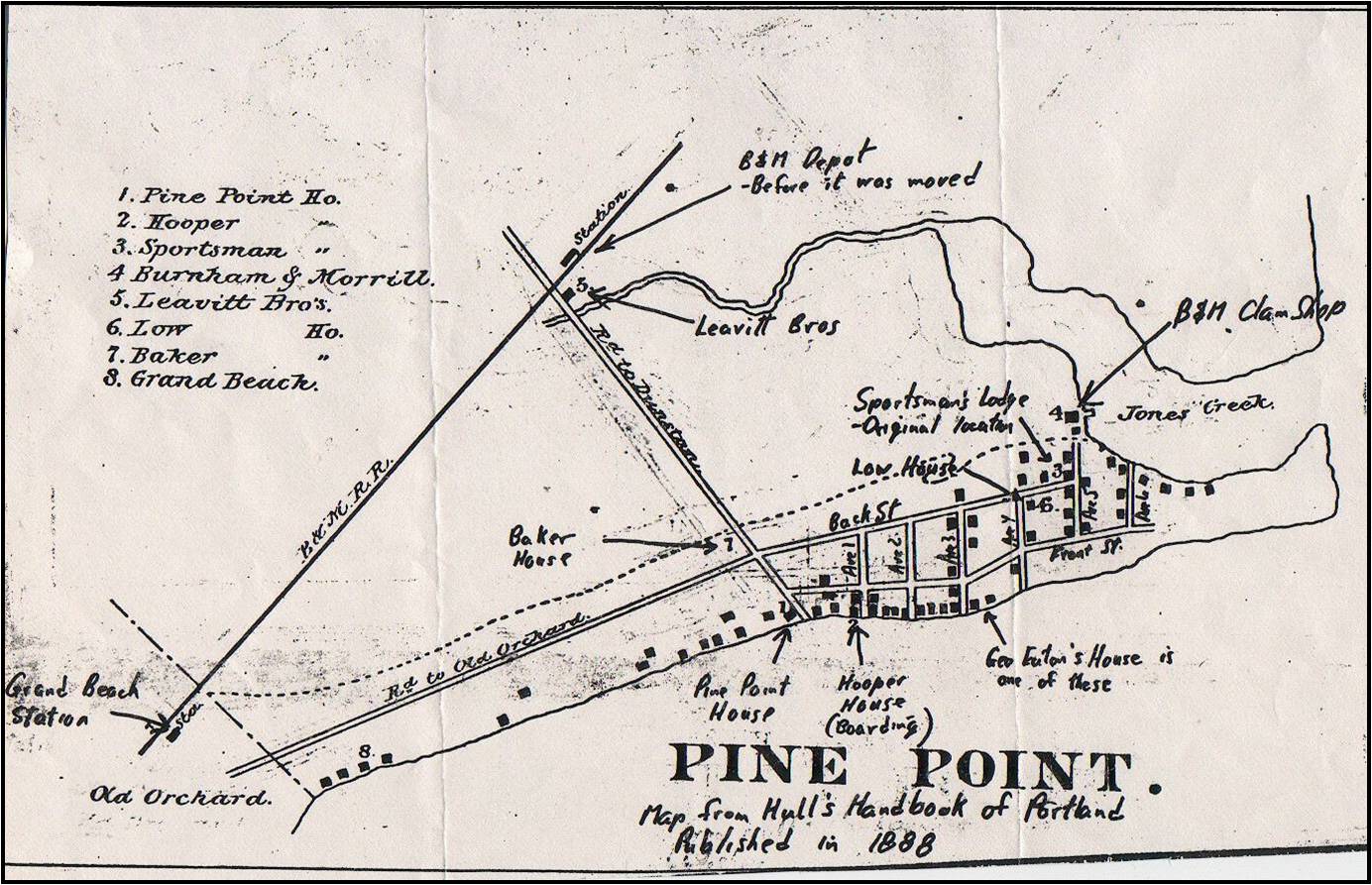
Map of Pine Point Taken from Hull's Handbook of 1888
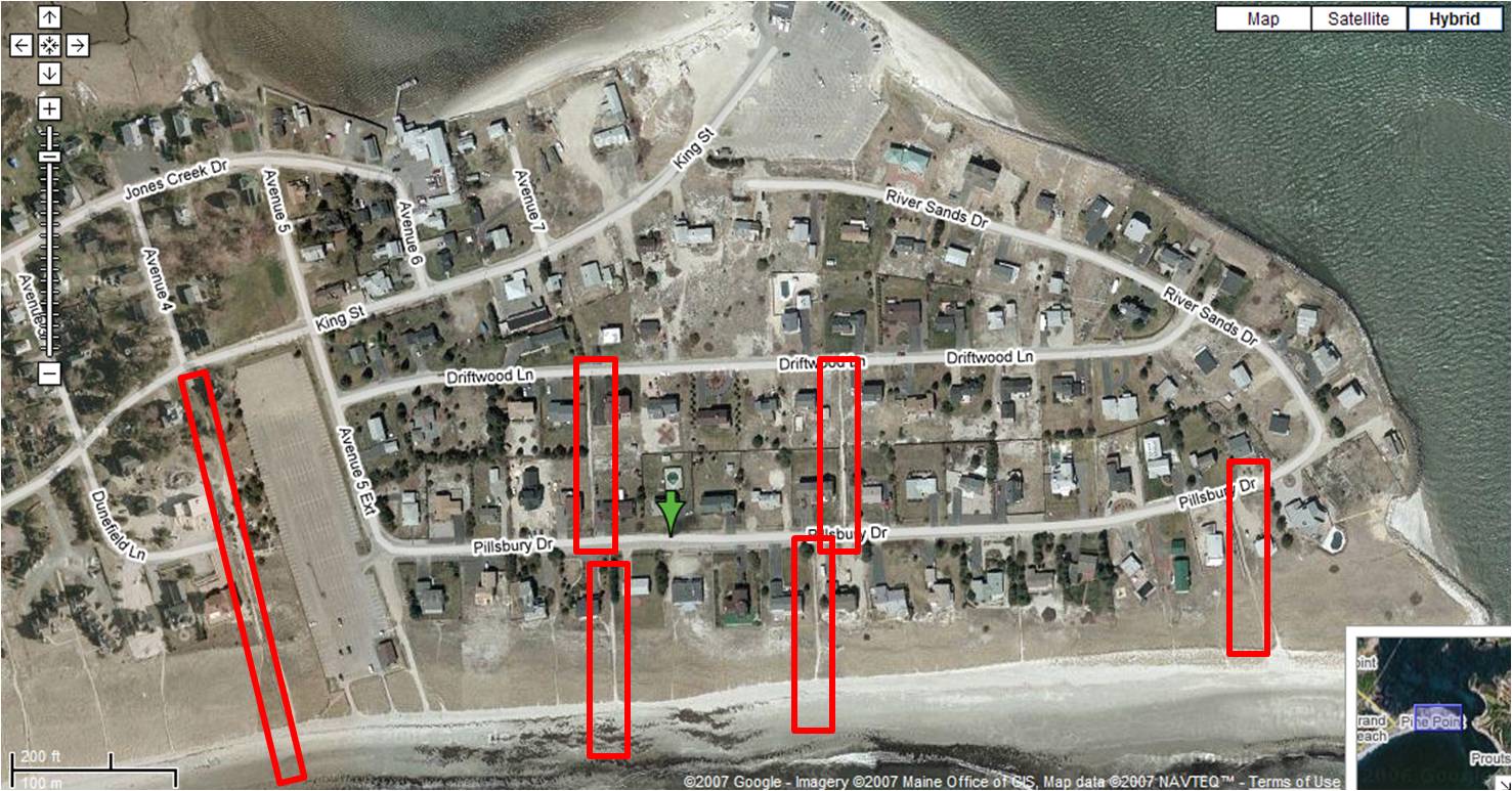
Aerial Photo of Pillsbury Shores to Avenue 3 / Dunefield Land Showing Rights of Way
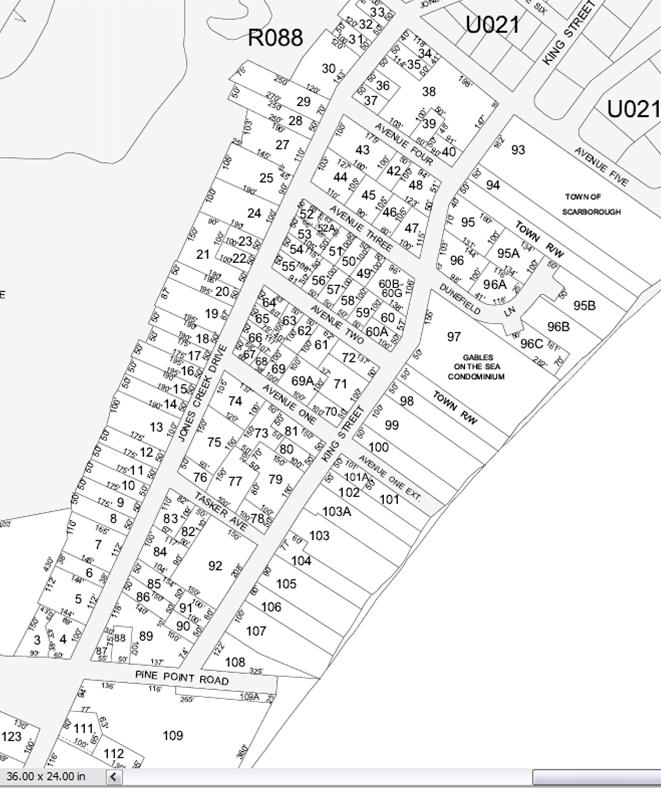
Scarborough Tax Map Printed 2007
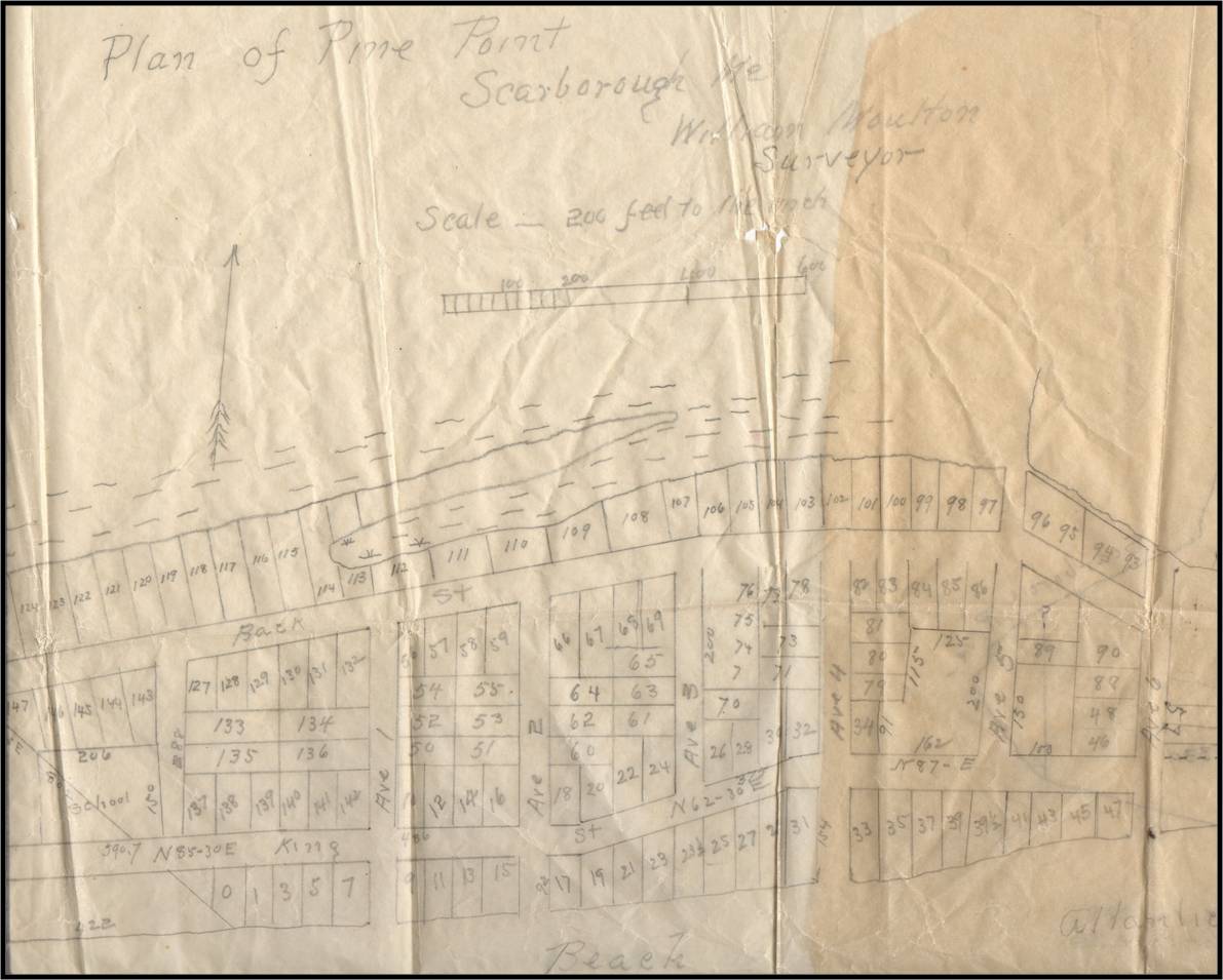
William Moulton Survey Plan of Pine Point,
1888
(Plan Book 6, Page 36, Recorded 12/1/1888)
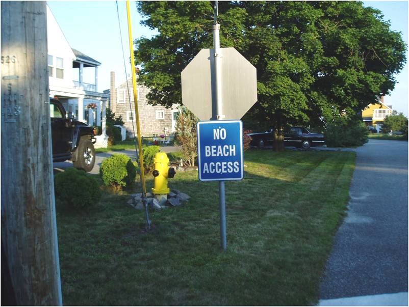
Sign Which Appeared Summer of 2007 at Dunefield and King St. Not Installed by Town
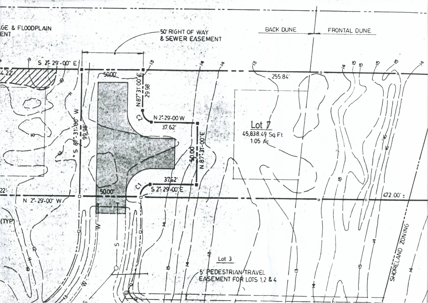
Portion of Final Approved Plan for Dunefield Lane
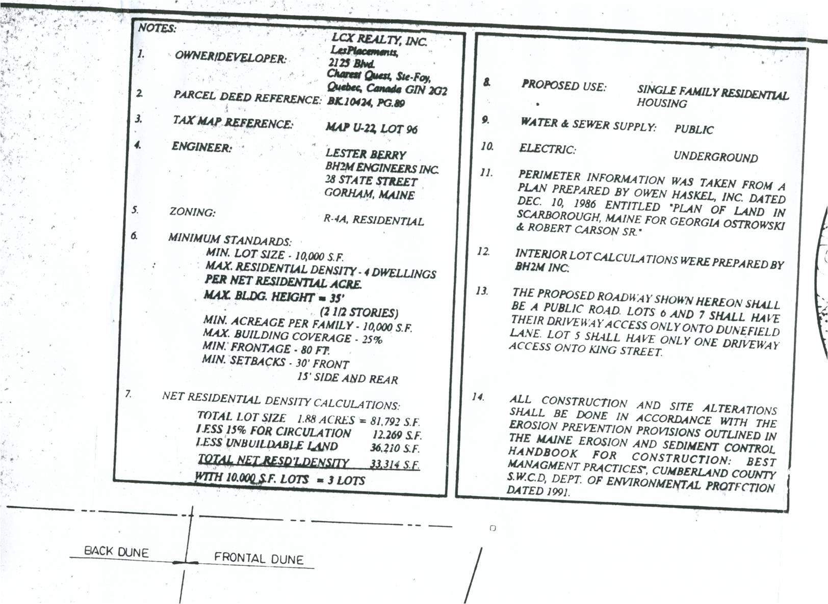
Portion of Notes from Final Approved Plan for Dunefield Lane
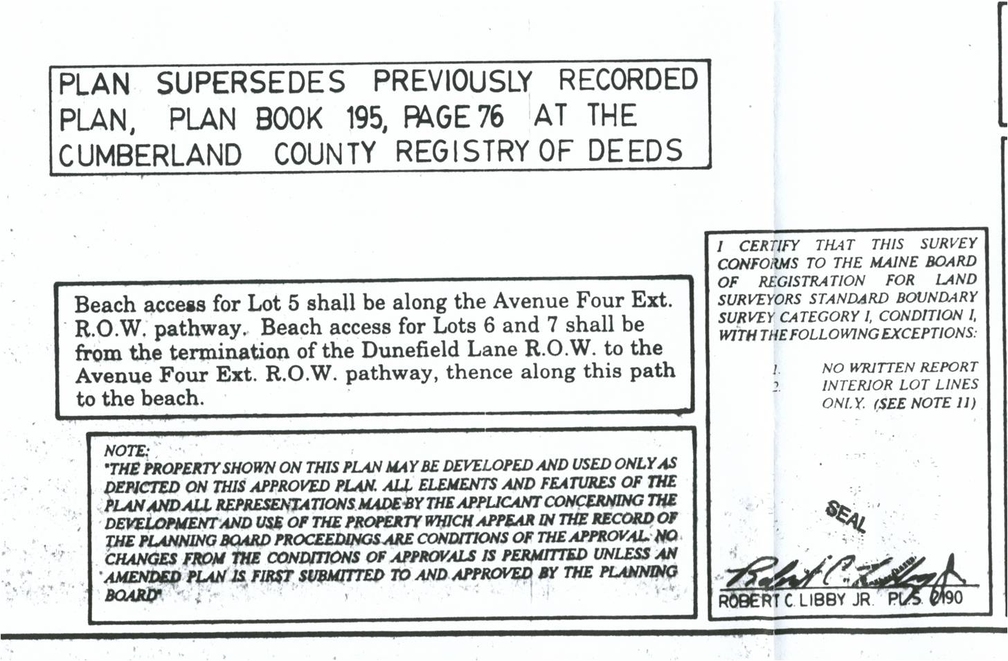
Portion of Notes from Final Approved Plan for Dunefield Lane